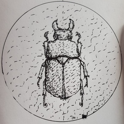
Des gens ont imaginé la colonisation de #venus . J'ai cru à une blague au début. Mais non, apparemment, à 50km d'altitude pression et températures sont acceptables.
Faut aimer les montgolfières.
Du coup ça me pose une question: pourquoi la #propagande #technofasciste choisit #mars alors que ça semble plus difficile que Vénus?
Le minerai (sur Vénus avec 93 bars et 400°C ça semble difficile), juste la com qui passe mieux, autre?
#politique #musk #fascisme #spatial #manipulation #ecologie #co2
Recent searches
Search options
#spatial
8 posts8 participants0 posts today


 Greg Cocks
 Glacial Lake Mapping Using Remote Sensing Geo-Foundation Model
--
https://doi.org/10.1016/j.jag.2025.104371 <-- shared paper
--
HIGHLIGHTS:
• Proposed U-ViT model based on Prithvi GFM for multi-sensor glacial lake mapping.
• Achieved an F1 score of 0.894 on Sentinel-1&2, surpassing CNNs scoring below 0.8.
• Maintains strong performance with 50% less training data, proving efficiency.
• Excels in detecting small lakes (<0.01km²) and handling clouds and complex terrains..."
#GIS #spatial #mapping #glaciallake #GeospatialFoundationModel #satellite #Sentinel #GaoFen #remotesensing #earthobservation #model #modeling #climatechange #glacial #glacier #melt #melting #UViT #deepleanring #AI #framework #performance #metrics #opensource


The Concept Of Indigenous GIS
--
Reading a paper (http://alturl.com/8wte5), they used the specific term ‘Indigenous GIS’ – and I found this intriguing!
As I read it, spatial data collection and analysis was done with a focus on how a tribe or social group might ‘see’ the data, including spatiotemporal....
I look forward to finding out more about what others are working on! – so PLEASE feel free to share any examples that you might have…
#GIS #spatial #mapping #indigenous #IndigineousGIS #FirstNation #perspective #cultural #social #naturalresources #archaeology #publicsafety #socialservices #planning #design #spatialanalysis #spatiotemporal #mapping #cartography #usecase #practical #pragamatic #resultsdriven #focused##


Satellite Imagery You Can Play With
--
https://hackaday.com/2025/03/10/satellite-imagery-you-can-play-with/ <-- shared technical article
--
https://tech.marksblogg.com/satellogic-open-data-feed.html <-- shared ‘how to’ article
--
[this post should not be considered an endorsement of any product or service]
#GIS #spatial #mapping #Satellogic #EarthView #satellite #cubesat #NewSat #microsatellites #GDAL #python #DuckDB #H3 #JSON #Lindel #Parquet #remotesensing #earthobservation #Aleph #NORAD #location #howto #tutorial #code #coding #metadata #imagery


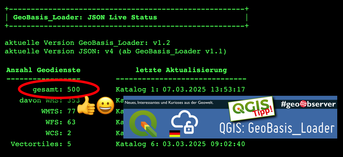
500 Dienste inklusive: Neuer Meilenstein im “GeoBasis_Loader” / 500 services included: New milestone in the ‘GeoBasis_Loader’ https://geoobserver.de/2025/03/10/500-dienste-inklusive-neuer-meilenstein-im-geobasis_loader/ #plugin #qgis #switch2qgis #opendata #GDI #lvermgeo #gistribe #gischat #fossgis #foss4g #OSGeo #spatial #geospatial #opensource #gis #geo #geoObserver pls RT


 #SAGEO2025
 #conference #internationale
International conference
_#spatial #spatialAnalysis and #geomatics #geomatique
Avignon 22-23/05/2025
 Ouverture des inscriptions !
 https://sageo2025.sciencesconf.org
Et juste avant, Ecole Thématique CNRS sur la #robustesse 

 Ateliers des AR MAGIS, dont #ar9MAGIS


Need spatial data?
The list of ArcGIS server addresses that I curate now has over 4,000 addresses for ArcGIS servers at all levels of USA government, from federal to local.
Last fall, Jonathan at https://www.geoseer.net/ (spatial data search tool) sent me a massive list of ArcGIS server addresses that have been detected by their scanning methods. I finally had a chance to process that information and added *many* ArcGIS server addresses to the list I curate. Thanks Jonathan!
#GIS #ArcGIS #Data #Spatial #Geospatial #Maps #Mapping
Curated USA ArcGIS server list (pdf):
https://mappingsupport.com/p/surf_gis/list-federal-state-county-city-GIS-servers.pdf
A Methodology For The Multitemporal Analysis Of Land Cover Changes And Urban Expansion Using Synthetic Aperture Radar (SAR) Imagery - A Case Study Of The Aburrá Valley In Colombia
--
https://doi.org/10.3390/rs17030554 <-- shared paper
--
#GIS #spatial #mapping #SyntheticApertureRadar #SAR #remotesensing #multitemporalanalysis #landcover #landcoverchange #clustering #kurtosis #fuzzylogic #kernelbasedmethod #machinelearning #spatialanalysis #spatiotemporal #geostatistics #model #modeling #AburráValley #Columbia #urban #urbanexpansion #population #growth #topography #monitoring #satellite #sentinel #valley #landuse #distribution #infrastructure #building #roads #naturalresources #environmental #conservation #monitoring #multitemporal

. Central Park in Bello (B). Parques del Río Medellín (C). Arkadia Shopping center; (D). Peldar Plant (E). La García water supply reservoir (F). Conasfaltos dam (G). La Ayurá stream basin in Envigado (H). Central Park in Bello (I). Avenida Regional Norte (J). Vía Distribuidora Sur.")

 between the valleys of the Magdalena and Cauca rivers. Data were acquired from ALOS PALSAR Terrain Corrected and data from IGAC.")

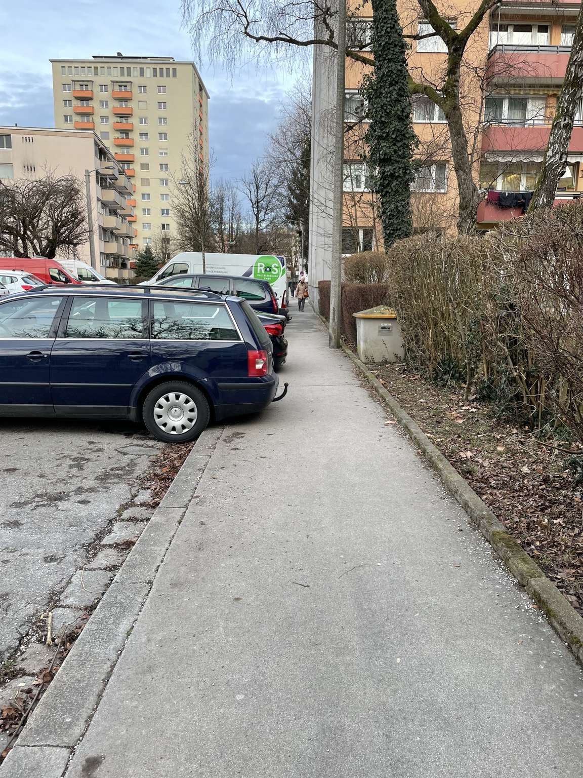
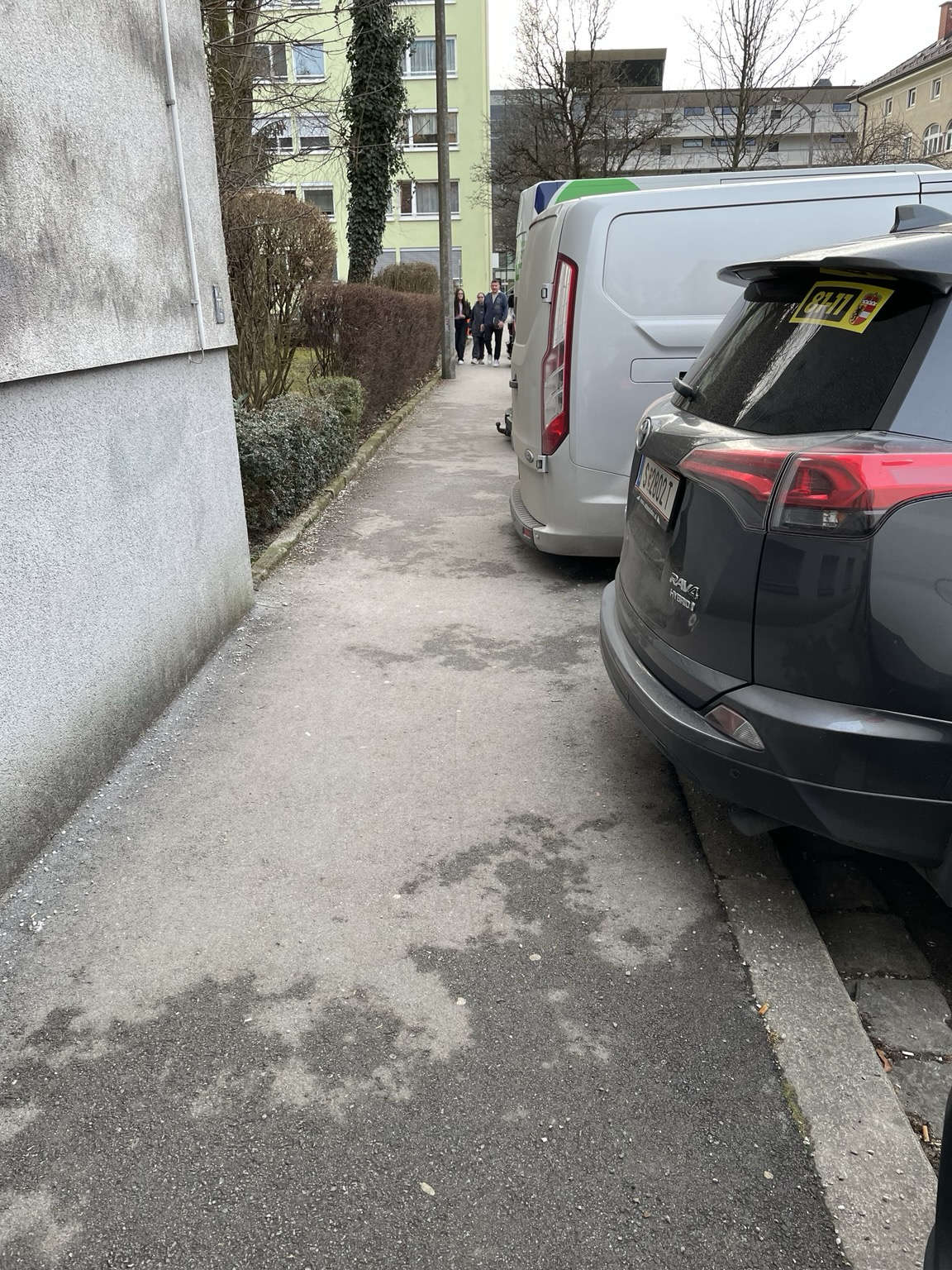
#Cars are a #spatial problem!
#Walkability could be easily improved by fixing the small, nasty but ubiquitous issues of daily urban life.  Reclaiming space that was dedicated to #pedestrians.
Gap Between Water Supply And Demand Will Increase As Climate Shifts, Analysis Finds
--
https://phys.org/news/2025-02-gap-demand-climate-shifts-analysis.html <-- shared technical article
--
https://doi.org/10.1038/s41467-025-56517-2 <-- shared paper
--
#GIS #spatial #mapping #spatialanalysis #spatialtemporal #watermanagement #waterresources #watersecurity #water #hydrology #watersupply #global #climatechange #warming #consumption #foodsecurity #agriculture #food #availability #economics #development #model #modeling #energy #scarcity #watergap #freshwater #groundwater #river #lake #aquifer #reserves #environment #stress #rainfall #precipitation #research #sustainable #planning #policy #gap #demand


If you are interested in maps and city views and especially in the 'boundaries' between city and countryside, please have a look at this video: https://www.youtube.com/watch?v=4SBmTdwOnQw
I call this #boundary a 'spatial differentiation'. Please share your thoughts.
The video could also be a useful teaching tool for BA seminars in in #History , esp. #urban and #spatial history.
... includes a reference to my work on Delagrive: https://shs.hal.science/halshs-04453469
@histodons @historikerinnen @medievodons @urbanism #space
")
Hello Fediverse!
I'm currently writing a master thesis where I will need to get some data on weather of different (mostly) European cities with some GPS coordinates for the last 5 years.
As this is a student project, I do not have much money to pay expensive API access to historical weather data.
Does anyone have a recommendation?
Thank you and try to be nice to yourself today :)
#python #api #spatial #WeatherData #weather #recommend

Hi #sciencemastadon, just migrated to social.edu.nl. A re-introduction: I'm a researcher working at Wageningen University and Research (#wur), studying the #ecology of #marinemammals (mostly #seals) in the Netherlands or #arctic, analysing #spatial distribution and #habitat selection based on #wildlife #tracking or #drone/ #uav/ #satellite data using #rstats
Also interested in human #behavioural ecology and alternative economic systems like #degrowth/ #postgrowth
Below movie of our research

Un article intéressant sur Mars avec des descriptions claires de challenges techniques et plus profondement de la façon dont "on fait les choses maintenant" et comment une foule de choses doit être fait complètement différemment !
Mars n'est pas juste une peu plus loin !
On ne réalise pas à quel point c'est différent
https://idlewords.com/2025/02/the_shape_of_a_mars_mission.htm
Cc @maisouvaleweb
#Mars #Spatial #Science
idlewords.comThe Shape of a Mars Mission (Idle Words)
Do you have a PhD related to user experience (UX) design/AR/VR/HCC/spatial human-computer interaction/physical computing/accessibility? On Feb 28th my School begins reviewing applications for an assistant prof to start fall 2025.
https://fa-ewca-saasfaprod1.fa.ocs.oraclecloud.com/hcmUI/CandidateExperience/en/sites/CX_1/job/727

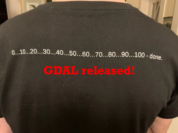
GDAL Released: v3.10.2 – “Gulf of Mexico” https://geoobserver.de/2025/02/17/gdal-released-v3-10-2-gulf-of-mexico/ via @GdalOrg @EvenRouault #gdal #ogr #qgis #switch2qgis #fossgis #foss4g #opensource #gistribe #gischat #spatial #geospatial #gis #geo #geoObserver pls RT
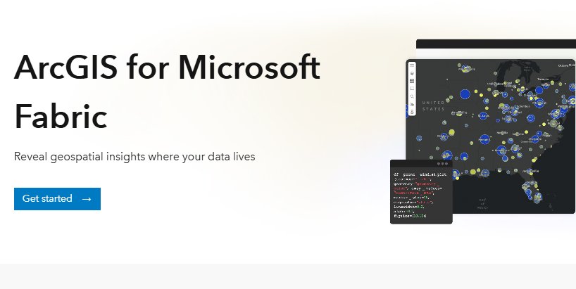
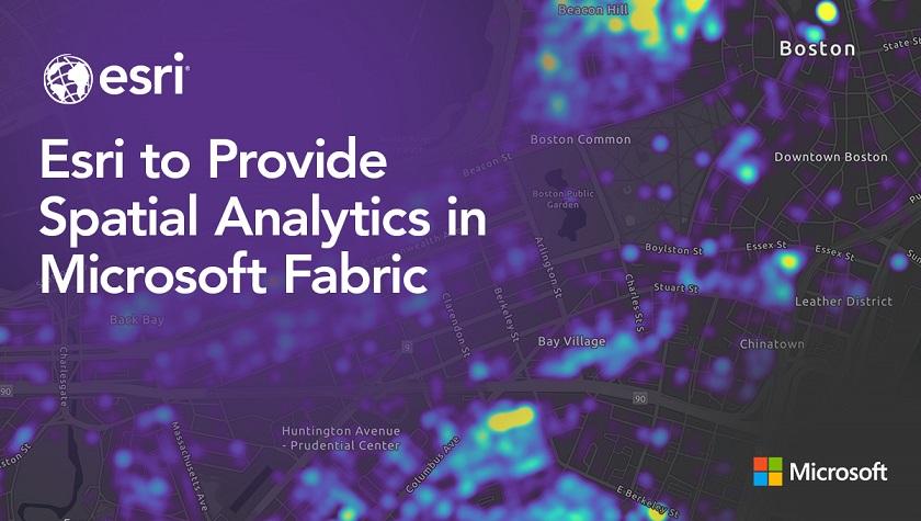
#Esri is integrating spatial analytics within #Microsoft Fabric. Generate insights from your own #location #data using #ArcGIS tools and libraries in Fabric. https://www.esri.com/en-us/c/product/spatial-analytics-in-microsoft-fabric
#spatial #business #intelligence #geospatial #GIS #analysis #PowerBI #dataviz #GISchat #geospatial #mapstodon @esri @esrifederalgovt @esrislgov @urisa @microsoft @msftnews

Data Request For Potomac River Tragedy - National Centers For Environmental Information (NCEI), NOAA In The News
--
https://www.ncei.noaa.gov/ <-- shared NCEI home page
--
“A CNN Reporter requested data to portray the depth of the Potomac River near the site of the tragic plane and helicopter crash. The Digital Elevation Model Bathymetry (DEM) Team responded with information on how to use NCEI’s high-resolution Continuously Updated Digital Elevation Models (CUDEMs) to generate a map of the Potomac River and provided an example map…”
#GIS #spatial #mapping #remotesensing #bathymetry #topobathy #DEM #elevation #depth #NCEI #opendata #CUDEM #disaster #collision #air #potomacriver #potomac #crash #airdisaster #Washington #helicopter #ArmyHelicopter #blackhawk #NOAA #aviation #midair
@NOAA @NCEI

